Floyds Fork Fishing Spot
- Elevation: 438'
- Last Modified By: vinny60 on 09/09/09 11:49 AM
- Ask about Floyds Fork in our Fishing Forums
Photos
Fish Species
Floyds Fork Description
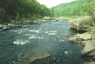
A main tributary of the Salt River, Floyds Fork flows southwest along the Oldham–Shelby County line, across western Jefferson County, and into Bullitt County, where it joins the Salt River near Shepherdsville. Access is good, especially in Jefferson and Shelby Counties, where the banks are not particularly steep.
Floyds Fork River (locally just called Floyds Fork) is a tributary of the Salt River in Kentucky, directly south and east of Louisville. It begins in Oldham County near Floydsburg, flows through eastern Jefferson County and flows into the Salt River near Shepherdsville in Bullitt County.