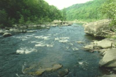
Salt River Fishing Spot
- Elevation: 541'
- Last Modified By: vinny60 on 09/09/09 04:02 PM
- Ask about Salt River in our Fishing Forums
Photos
Fish Species
Salt River Baits and Tackle
Crankbait Check Prices
- Rapala DT 10 crawfish
Creature Check Prices
- Yum Wooly Hawgtail Green Pumpkin
Nightcrawler Check Prices
Salt River Description
A main tributary of the Salt River, Floyds Fork flows southwest along the Oldham–Shelby County line, across western Jefferson County, and into Bullitt County, where it joins the Salt River near Shepherdsville. Access is good, especially in Jefferson and Shelby Counties, where the banks are not particularly steep.
The Salt River is a 140 miles (225 km) long river in Kentucky that drains 2,920 square miles. It begins near Danville, Kentucky, rising from the north slope of Persimmon Knob south of KY 300 between Alum Springs and Wilsonville, and ends at the Ohio River near West Point, Kentucky. Taylorsville Lake is formed from the Salt River and Guist Creek Lake is also in its drainage basin via Breshears Creek and Guist Creek.